Building Workshop
Bridge Street, Struthers
Three small public projects on one downtown street: a creekside patio, a parking lot set with a salvaged date stone, and a pocket park for gathering and performance.
- Location
- Struthers, Ohio
- Years
- 2025 to 2026
- Status
- Drawings complete, not built
- Partner
- Community Improvement Corporation of Mahoning County and the Western Reserve Port Authority; Technical Resource Consultants (162 S. Bridge)
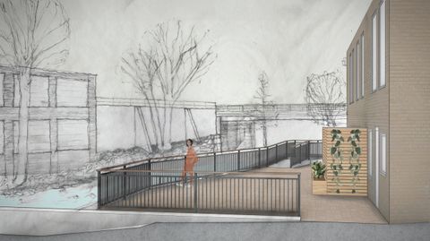
Bridge Street is the spine of downtown Struthers. Working with the Western Reserve Port Authority and the Community Improvement Corporation of Mahoning County, Black Flag designed three small public projects along it, each meant to give people a reason to stop.
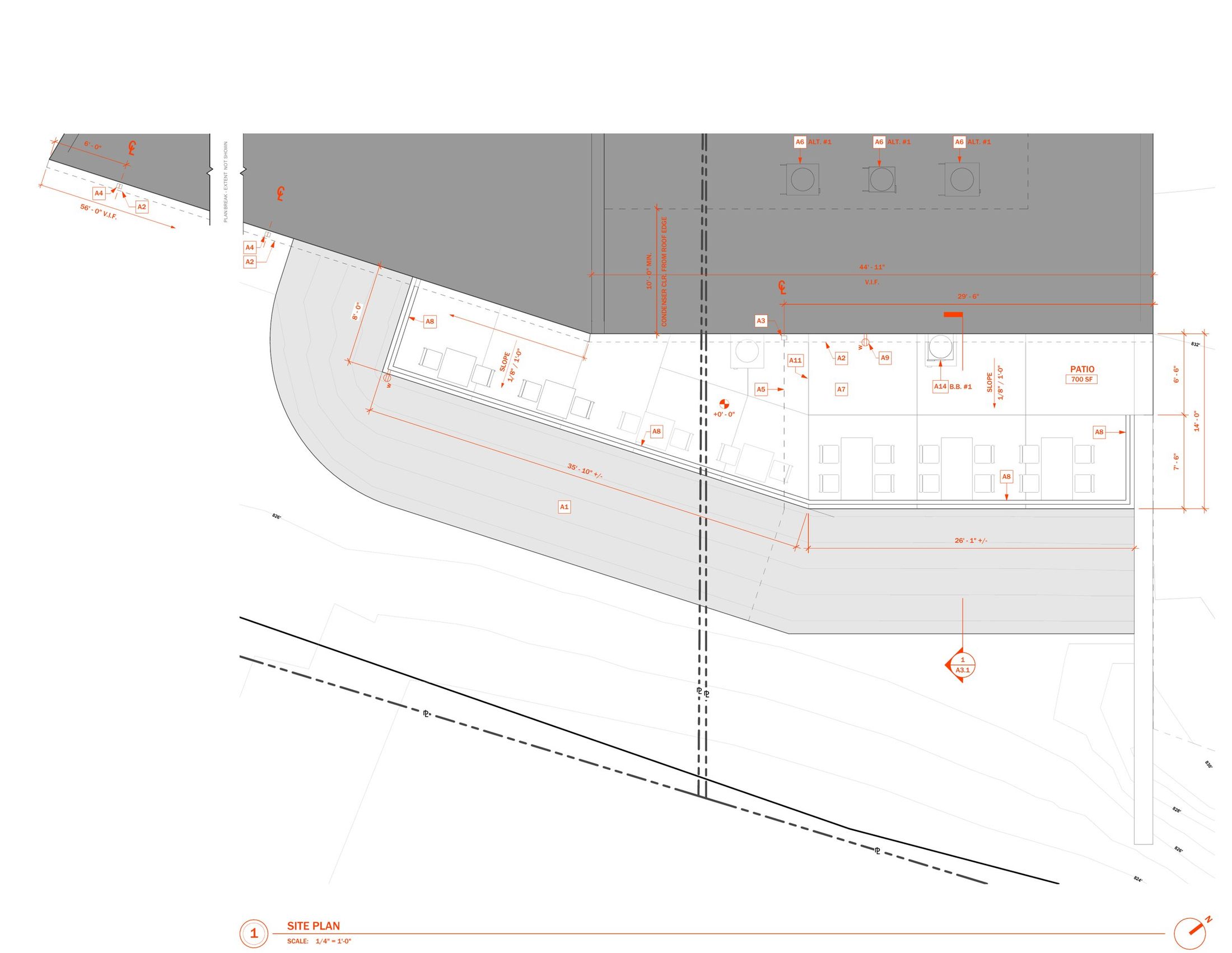
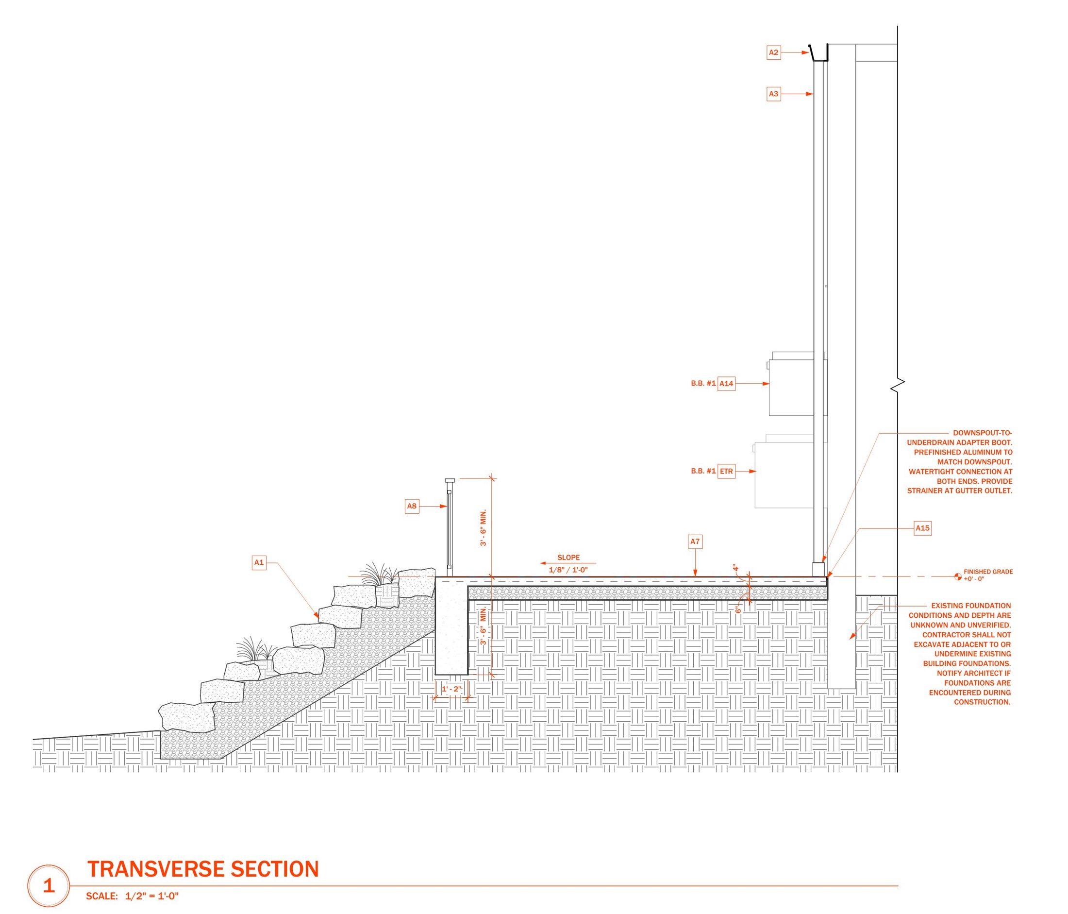
At 184 S. Bridge, a rear service yard on the bank of Yellow Creek becomes an 800 square foot coffee-shop patio: terraced stone walls, a stamped concrete terrace and native planting that stitch the building back into the creek corridor. A neglected back-of-house edge turns into a public overlook.
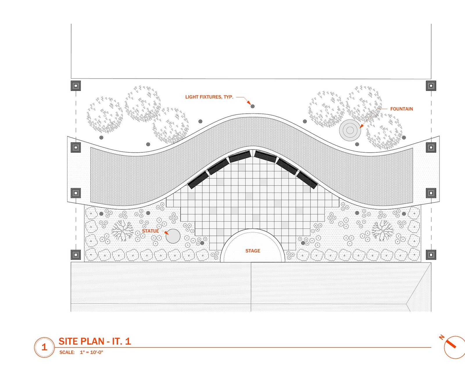
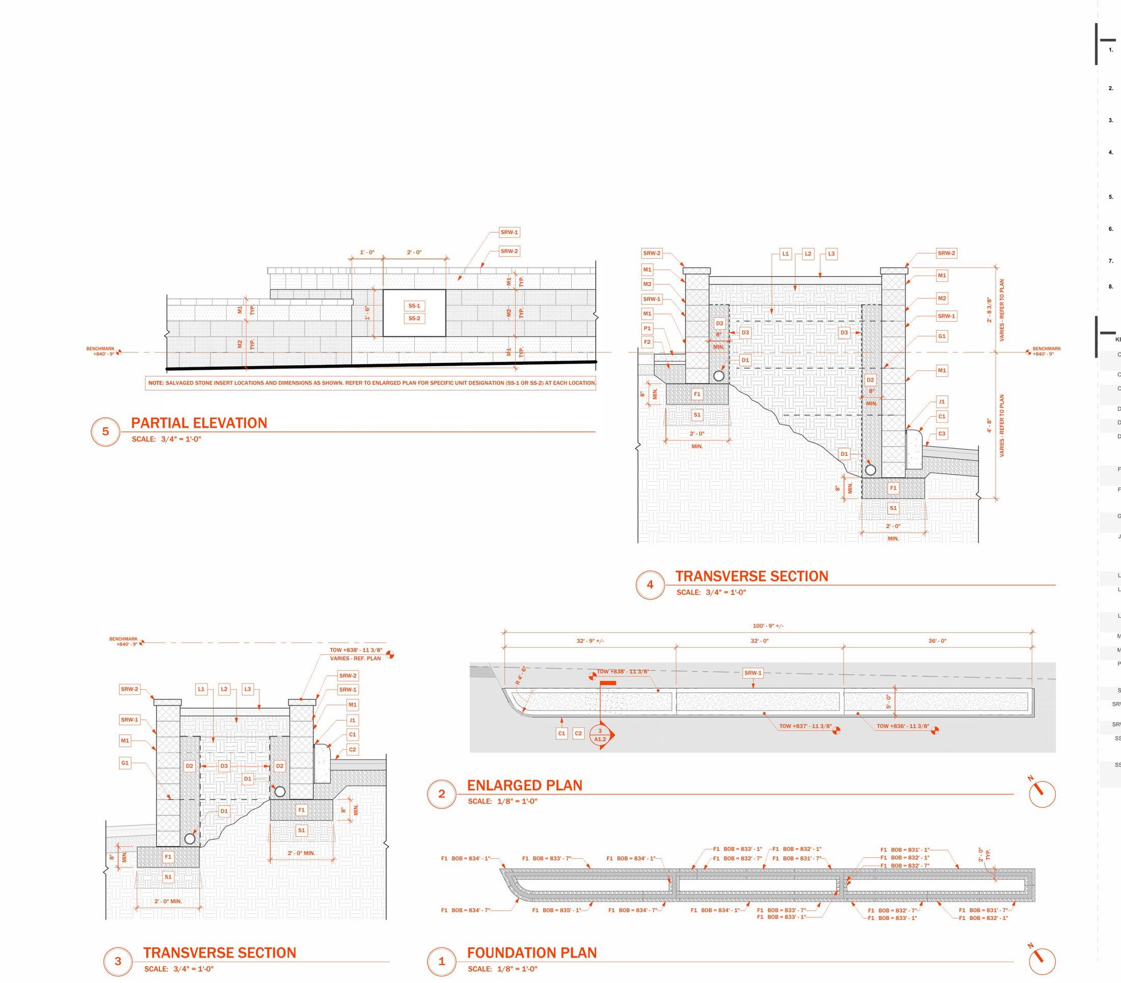
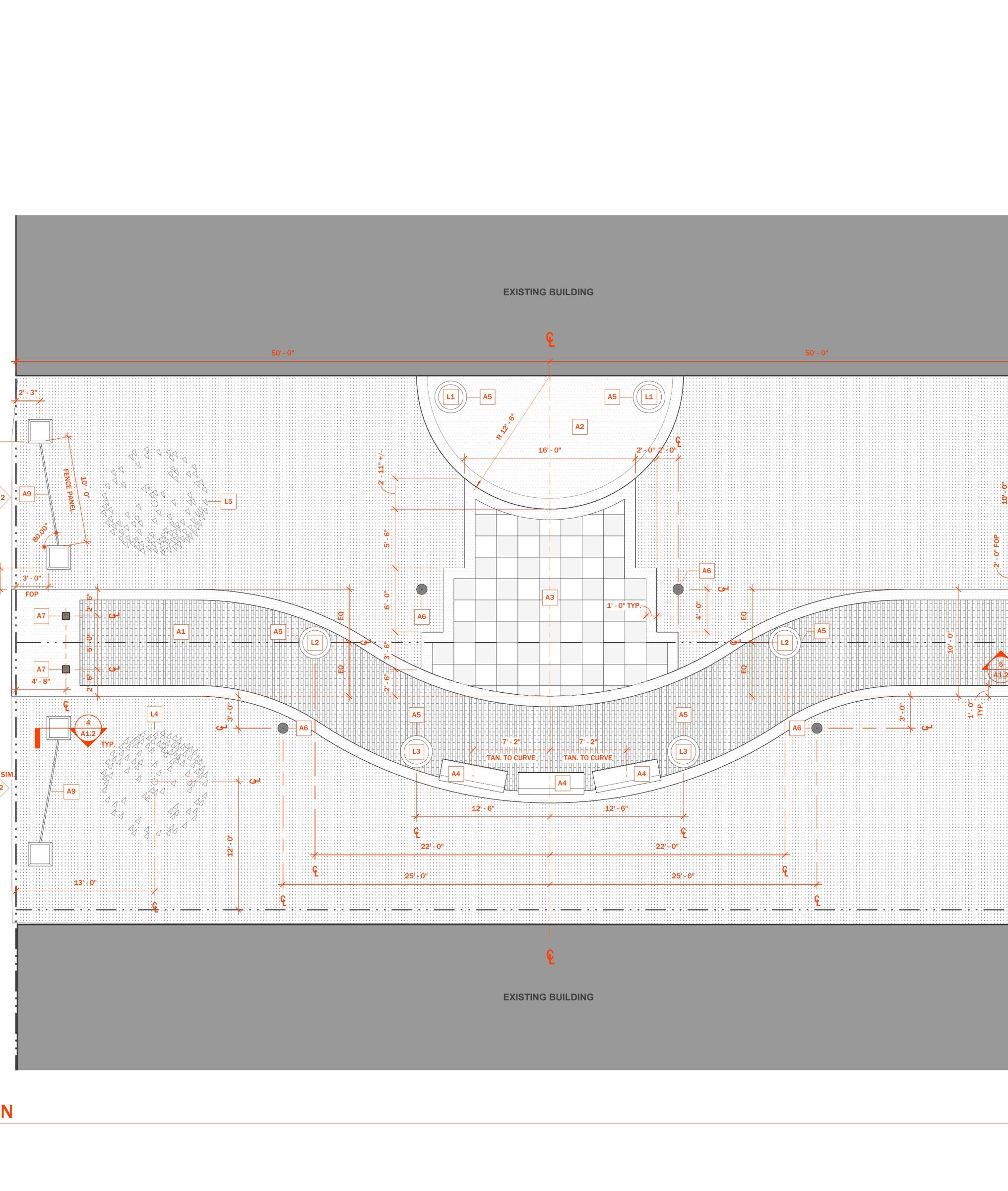
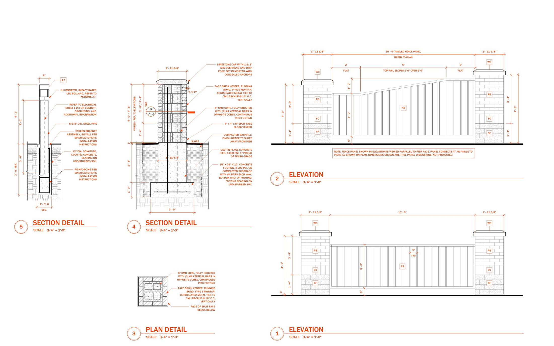
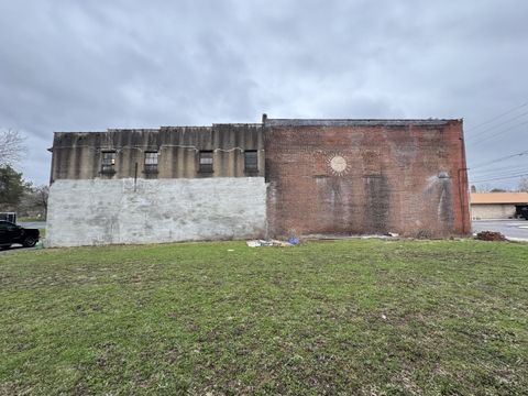
At 162 S. Bridge, working under Technical Resource Consultants, the project's civil engineer, a parking lot improvement adds native landscaping and segmental retaining wall planters that carry the date stone of a building the town lost. At 122 S. Bridge, a 5,000 square foot infill lot becomes a pocket park and small performance venue: a raised semicircular platform and checkerboard dance floor, stamped concrete walks, brick piers with steel fencing, and planted borders chosen to last. Bollard lighting and underground power support evening programs and food trucks along the alley.
The drawings are complete; the projects did not proceed to construction when federal recovery funding ended.
Process
One street, three sites, worked one after another. Each began with a walk of the site, then the drawings pushed it forward. Construction drawings appear as cropped excerpts, without notes or title blocks, and are not for construction.
-
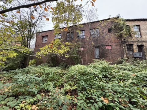
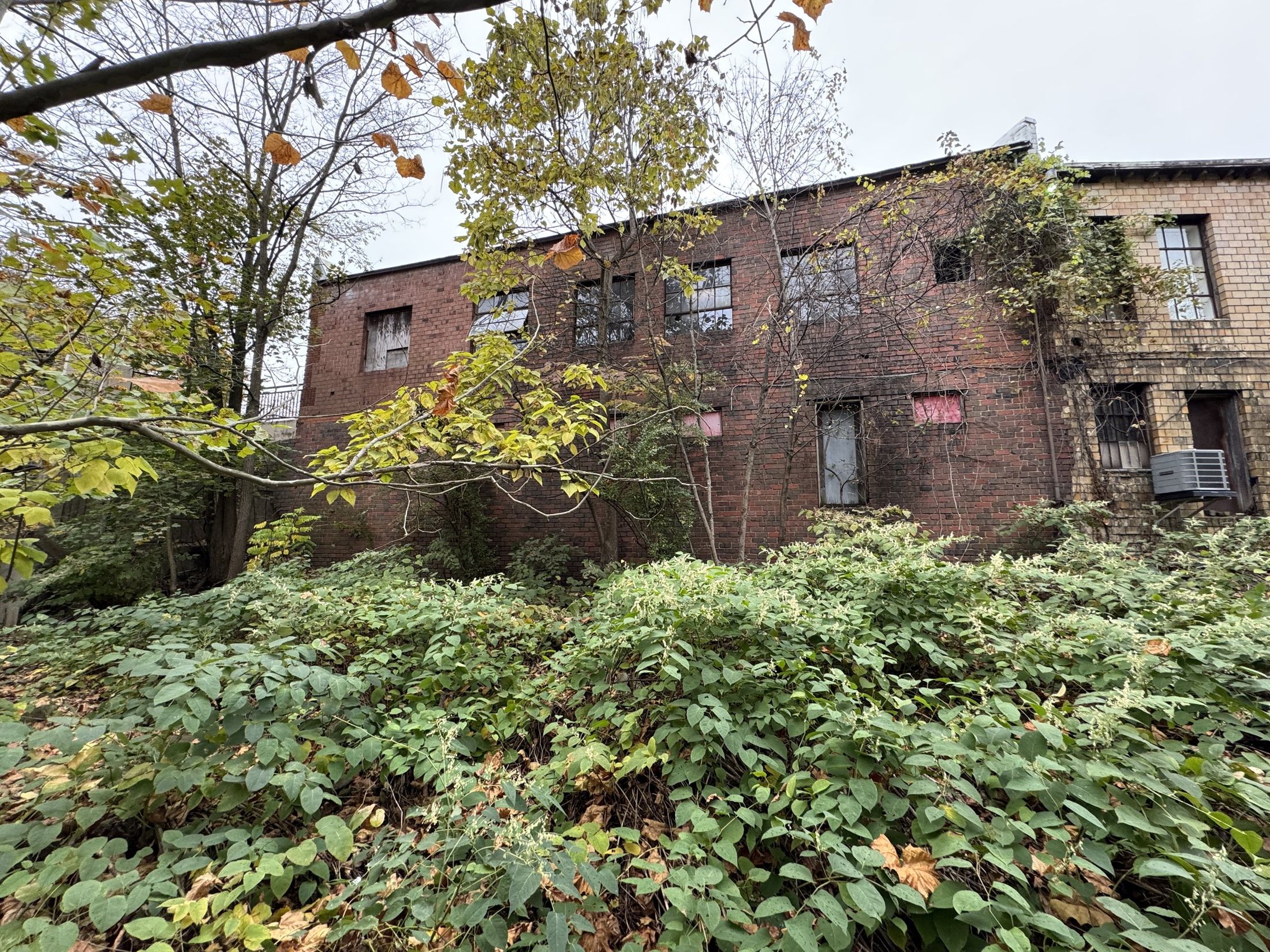
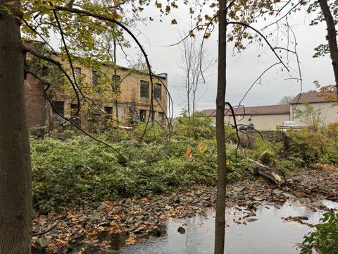
Site walk, 184 S. Bridge
The rear service yard, overgrown, with the creek just below. The patio starts here.
-
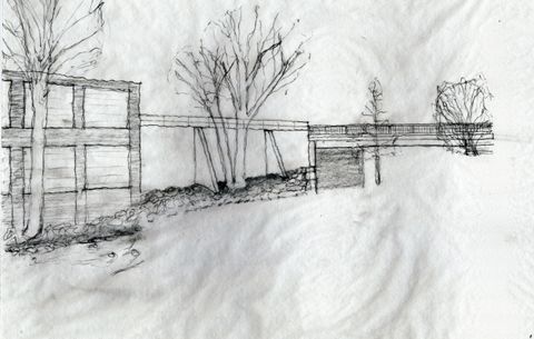
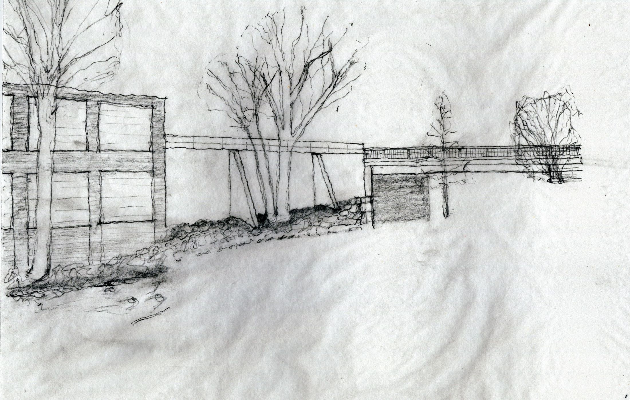
Arrival, ink on trace
The creek corridor drawn by hand first. The model went in over this drawing.
-
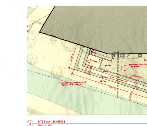
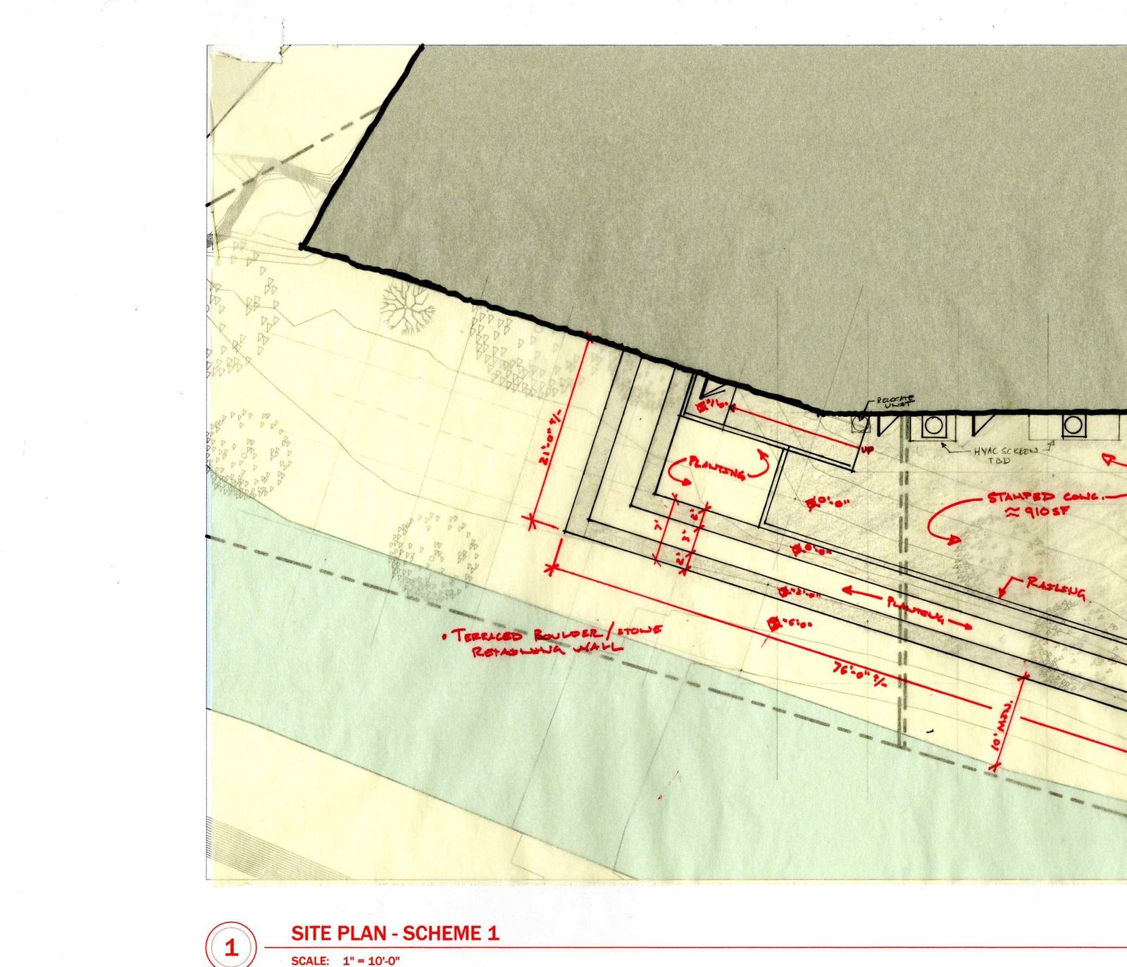
Patio, scheme 1
Marked up by hand over the site plan: terraced boulder and stone retaining walls, a ramp, stamped concrete stepping down to the creek.
-
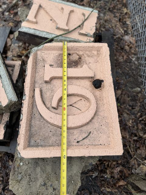
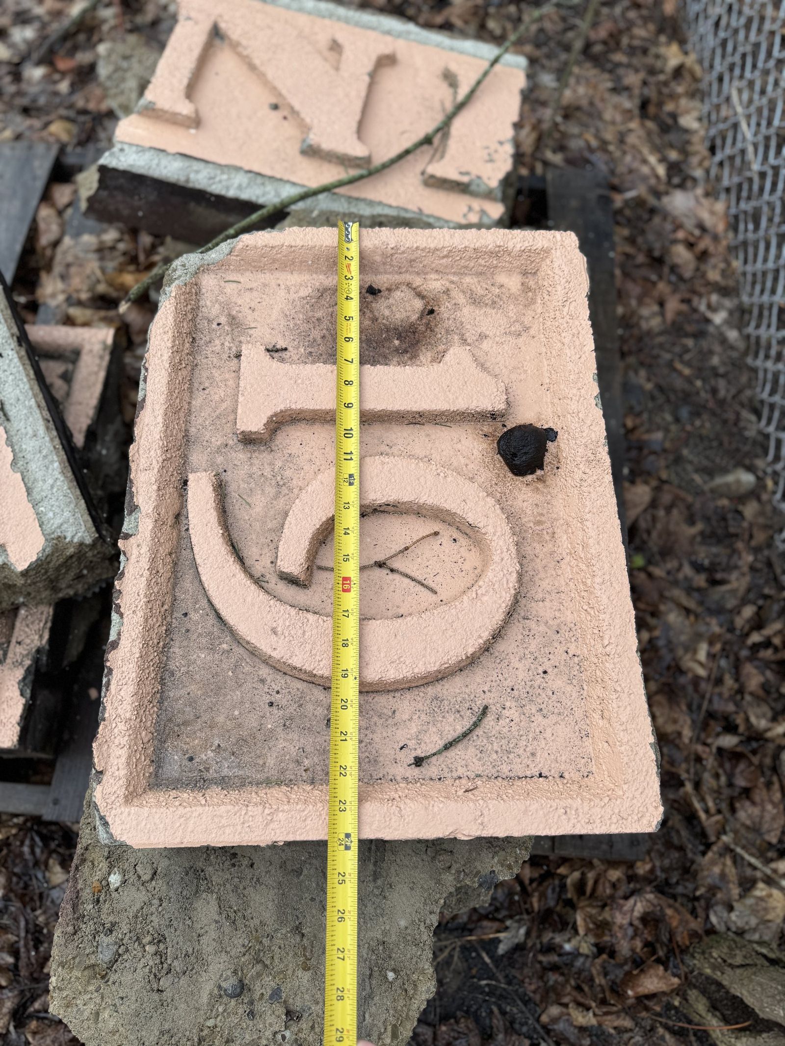
The date stone, measured
Pieces of a demolished building's date stone, measured on site to be set into the new planters at 162 S. Bridge.
-
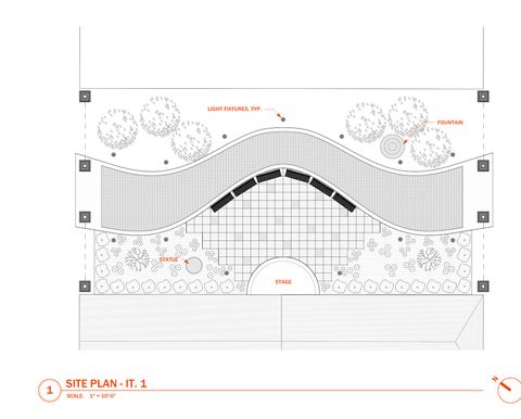
Pocket park, iteration 1
First pass at 122 S. Bridge: a wave of walkway, a checkerboard dance floor, a stage at the street.
-
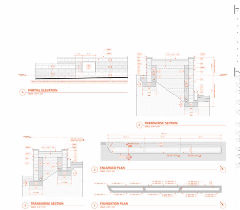
Planters, 162 S. Bridge
Segmental retaining wall planters along the lot, detailed to carry the date stone.
-
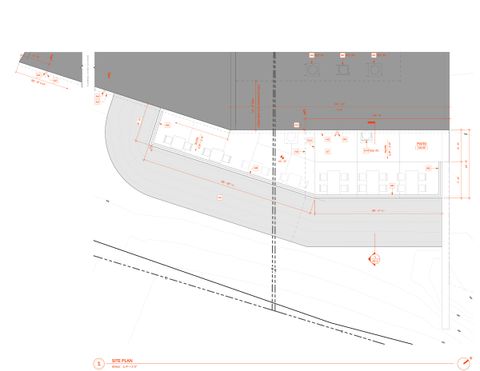
Patio, site plan
Scheme 1 drawn to scale: the terrace along the building, tables at the rail, the stone slope curving down toward the creek.
-
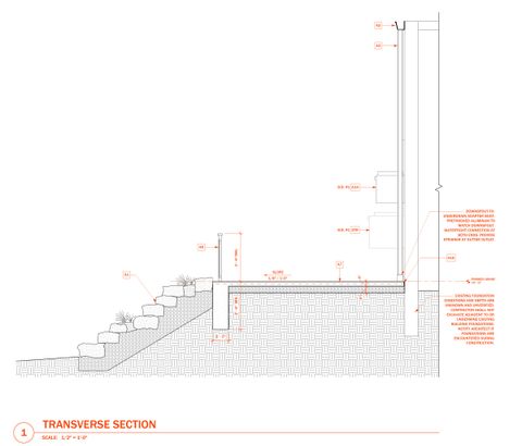
Patio, section
The cut through the bank: a slab against the old wall, a guard rail, stone stepping down with planting between.
-
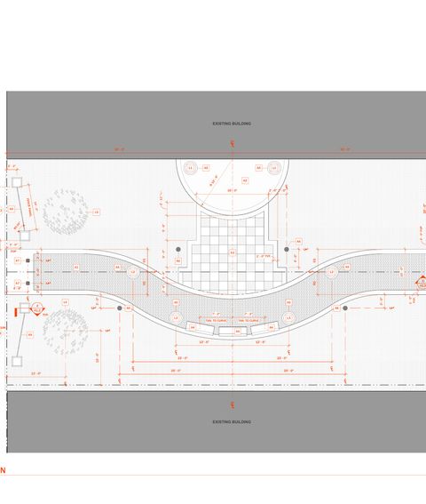
Pocket park, review set
The curve settled and dimensioned: raised semicircular platform, checkerboard floor, brick piers and fencing at the edges.
-
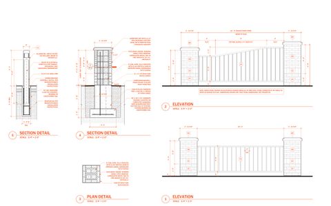
Pocket park, piers and fence
Brick piers with limestone caps, steel fence panels between, a lit bollard detail.